Photographs
_________________________________________________
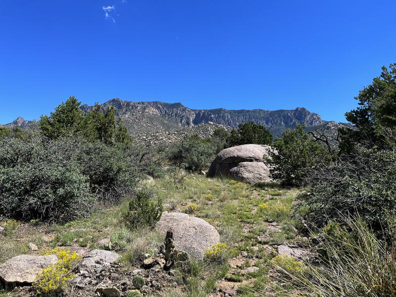
A small meadow a few feet away from Trail #365 north of Elena
Gallegos Open Space Area in the foothills with Sandia Peak and
the crest of the Sandia Mountains in the background. I stopped
here to sit on a rock and absorb everything around me for 15 or
20 minutes. It was just a very peaceful and pleasant place to sit for a while. I started hearing the cheep-cheep of a bird a little behind
me and to my right and turned to watch it moving along branches
of a mountain mahogany, seeming to pick things off the branches.
With blue on its crown and a white or light gray breast and darker
gray wings, I looked it up in a book later to learn it was a white-
breasted nuthatch, which hunts insects on tree branches.
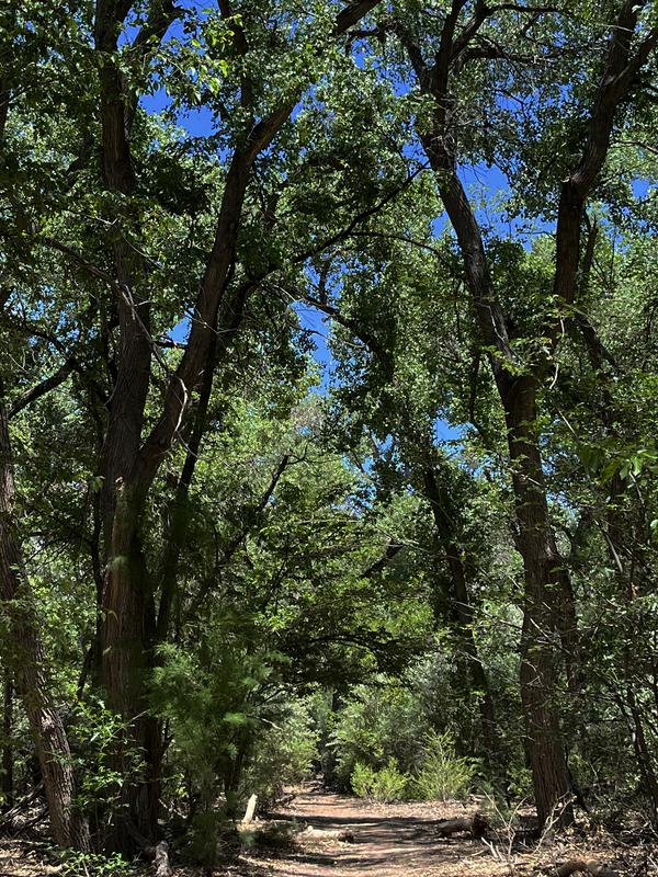
My spirit always soars when spring arrives in full force and flowering trees bloom while everything else turns green after a long winter of
bare trees, brown grass and cold. This is a photograph of a Bosque
trail north of Rio Bravo in Albuquerque's South Valley. It's the nicest
section of the Bosque with the densest forest and the tallest trees. It
looks so lush in spring and summer, and it's gorgeous in the fall when
the cottonwoods and mesquite turn gold, so even though it's a long
drive from where I live I get down there pretty often. Whoever had the
idea to preserve the Bosque as undeveloped land along the 25-mile
length of Albuquerque did the city a great service.
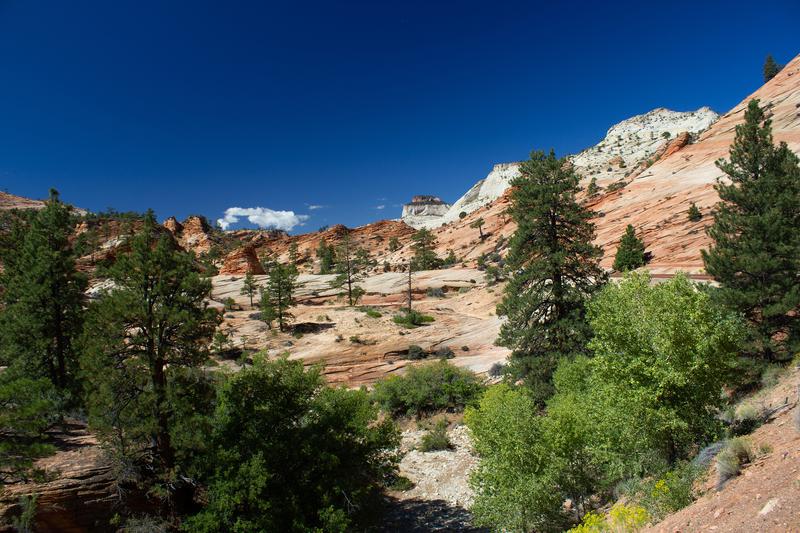
Zion National Park in southwestern Utah is one of the most visited
national parks in the country, along with Grand Canyon NP and Yosemite NP. When I went there in September, 2014 the area near
the entrance and visitor center was so jampacked with cars and
people that I decided to leave and go around to the east entrance
of the park to see what that offered. So I missed the canyon with
its monumental 2000-2600 foot walls, but was treated to a very
different experience on the eastern plateau above the canyon. The plateau was full of monumental stone formations on a smaller but
still very impressive scale, with great scenery of its own. One of
the more intriguing views was not of monumental stone slabs but
this view of a slickrock expanse with ponderosas growing out of
the rock, leading toward some cliffs in the distance. Slickrock,
which is not slick, is like the interstate of the wilderness. I love to
hike on it. It would have been nice to explore this scene, but I
didn't know if going offtrail was prohibited in Zion and I was eager
to get through the half-mile tunnel and down the interminable switchbacks to see if there was camping at the east entrance
to Zion Canyon. The canyon leading down to it was awesome in
itself, but I didn't see a campground. It was definitely worth the
drive though. It's a majestic place from the east side as well.

A shot of the eroded layers of sandstone forming the walls of Salt
Creek Canyon in the Needles District of Canyonlands National
Park, taken from the top of the mesa above. It's delightful to hike
these stairstep layers of rock, but I found when I tried to hike down
to the canyon bottom over them that the last layer had a sheer drop
of at least 40 feet, and I had to make a long detour back to the main
trail down into the canyon. There was a free-flowing spring with a
good-sized pool and a wonderful campsite under some junipers when
I got to the bottom of the canyon. It requires about a five-mile back-
pack to get down, but what a magical place to visit! It's like some god
poured a giant cauldron of multicolored taffy here that hardened eons
ago. There are at least 5 arches in this upper section of the 28-mile
hikeable trail in the canyon, one of which is perfectly round and thin
like a ring called Wedding Ring arch. It's not where the Trails Illustrated map says it is, though. This photo is cropped from a much wider view
of the canyon, so it's not as sharp as I'd like, but it shows the stairstep
layers well.